
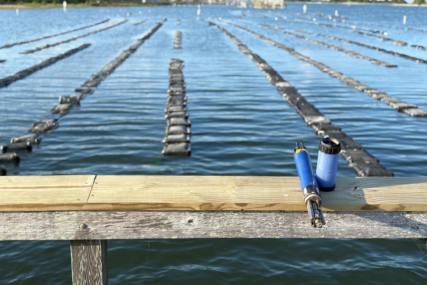
Probably not. The N.C. Coastal Reserve’s research biologist, Dr. Byron Toothman, identifies this phenomenon from data collected via a sonde, a water quality measurement instrument. Toothman manages all of the System-Wide Monitoring Program (SWMP) stations around Masonboro Island Reserve, including a new station located on UNCW’s Center for Marine Sciences dock.
In March, a weather system swept across much of the eastern U.S., bringing strong winds, intense rainfall, and tornadoes. In southeastern North Carolina, it also triggered a lesser‑known coastal phenomenon called a meteotsunami.
Unlike seismic tsunamis, meteotsunamis are triggered by fast-moving weather events that produce abrupt changes in surface air pressure and wind stress. Think strong thunderstorms and squalls. Depending on where in the world you might be, these events may go by different names, including ressaca (Portuguese), marrubbio (Italian), and abiki (Japanese).
Though they differ in origin from seismic tsunamis, they can still cause destructive flooding. Especially when they coincide with sunny day flooding. These phenomena commonly produce water‑level changes of one to two feet, with periods ranging around one to three hours, though stronger events can and do occur.
During this event, the Reserve’s SWMP meteorological station recorded a rapid rise in air pressure from 1005 mb to 1020 mb, winds shifted sharply from 22 mph out of the SSW to 24 mph from the north, gusting reaching 54 mph, all in just under six hours. Shortly afterward, a small meteotsunami became visible in the tidal record (below).
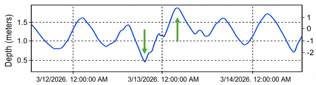
In the graph below, the observed high and low water levels (green arrows) are amplified where the meteotsunami constructively interferes with the tide. This resulted in the high tide being nearly one foot higher than predicted. It’s not difficult to imagine how this might exacerbate a king tide! It’s also possible to see that the expected intertidal ebbing and flooding are also briefly disrupted, inducing a brief pause or total reversal of tidal flow.
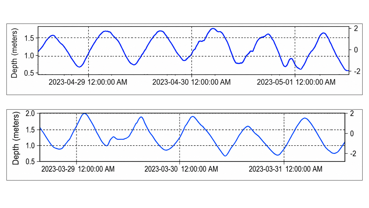
Meteotsunamis are not rare phenomena along our coast. The plots below show two similar events that occurred just one month apart.
When a meteotsunami triggering weather event occurs between Wilmington and Cape Lookout it can lead to a long period wave “trapped” against the shoreline as it propagates southward. The slope of the ocean floor slows the near‑shore portion of the wave, bending it toward the coast and guiding it along the shoreline. When this happens, these waves can easily be tracked on their southward journey by following data reported by programs like National Estuarine Research Reserve System (NERRS) and Coastal Ocean and Research Monitoring Program (CORMP) as it moves past monitoring stations.
Next time you notice the tide being higher than predicted and suspect a meteotsunami, look at the data! If you need help, Toothman keeps an eye on the data collected from the sondes at Masonboro Island and Zeke’s Island Reserves and is always happy to help folks work through the 20 years of data he tracks.