
Resilience Planning & Policy
Planning for coastal resilience is complex, and every community brings a unique set of challenges, strengths, and perspectives. Effective planning requires an interdisciplinary approach and a strong commitment to collaboration and partnership. Across North Carolina and the nation, communities are making impressive strides and building a wealth of shared knowledge. Yet, translating those lessons into action at the local level is often easier said than done.
To support your community’s efforts, explore the resources below from the Division of Coastal Management (DCM) and other trusted sources. These include best management practices designed to inform and inspire resilience planning at both the local and regional scales.
For a more structured starting point, explore resilience planning tools and datasets on the Division of Coastal Management Tools and Data page to access established planning processes and self-assessment checklists that can help you identify and prioritize key issue areas.
Getting Started
Before exploring the available options below, consider reviewing the NC DEQ CAMA Land Use Planning Guide by clicking the link or the image below.
Planning & Policy Topics
Integrating Resilience and Climate Adaptation into Comprehensive Planning:
A community’s comprehensive plan, sometimes called a land use or general plan, is the primary framework guiding long-term decision-making about growth and development. It balances the three pillars of a thriving community: social systems, the economy, and the natural environment. Because of its broad scope, the comprehensive plan provides an ideal foundation for addressing complex, cross-cutting issues like resilience and climate change adaptation.
Comprehensive plans typically cover interconnected topics such as transportation, affordable housing, economic development, and environmental protection. Communities are increasingly recognizing how each of these areas is directly affected by natural hazards, including flooding, sea level rise, coastal erosion, severe wind, extreme heat, and even wildfire risk. In response, many are finding new ways to embed hazard mitigation, disaster recovery, sustainability, and climate adaptation goals into the processes and policies that shape their plans. These efforts are essential for developing the ordinances, regulations, and incentive programs that foster vibrant, resilient communities in a changing climate.
Integrating Resilience and Climate Adaptation into Comprehensive Planning
A community’s comprehensive plan, sometimes called a land use or general plan, is the primary framework guiding long-term decision-making about growth and development. It balances the three pillars of a thriving community: social systems, the economy, and the natural environment. Because of its broad scope, the comprehensive plan provides an ideal foundation for addressing complex, cross-cutting issues like resilience and climate change adaptation.
Comprehensive plans typically cover interconnected topics such as transportation, affordable housing, economic development, and environmental protection. Communities are increasingly recognizing how each of these areas is directly affected by natural hazards, including flooding, sea level rise, coastal erosion, severe wind, extreme heat, and even wildfire risk. In response, many are finding new ways to embed hazard mitigation, disaster recovery, sustainability, and climate adaptation goals into the processes and policies that shape their plans. These efforts are essential for developing the ordinances, regulations, and incentive programs that foster vibrant, resilient communities in a changing climate.
Updated CAMA Comprehensive / Land Use Planning Guidance
To explore how communities are incorporating climate adaptation, resilience, and sea level rise into their Coastal Area Management Act (CAMA) Land Use Plans, visit the Division of Coastal Management Coastal Management Land Use Planning page.
- Click here to download the CAMA Land Use Planning resilience and hazard integration guide
Provides recommendations and tools for incorporating hazard mitigation and coastal resilience into comprehensive plans.
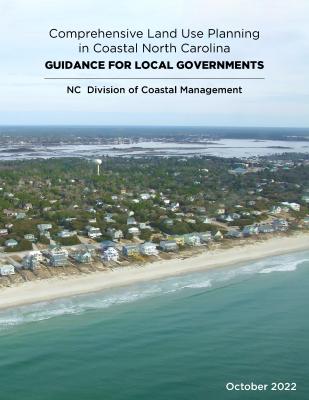
You can also click on the image below to access the Land Use Planning Guide.
Example Projects
Several examples below highlight how communities have successfully integrated resilience and climate adaptation into planning processes.
| Title | Focus Area | Partners | Summary |
|---|---|---|---|
| Morehead City Floodplain Management Plan (2017) | Floodplain Management | Multiple Partners | Morehead City identified and sought to address a number of flood-related hazards, including climate change and sea level rise, gaining numerous FEMA Community Rating System credits. |
| Town of Nags Head Coastal Resilience and Sea Level Rise Planning (2017) | Vulnerability, Consequences, Adaptations Planning Scenarios (VCAPS) process | NC Sea Grant, UNC Coastal Studies Institute, NC State University, Binghamton University, and Carolinas Integrated Sciences & Assessments (CISA) | Nags Head is leading through its integration of VCAPS results with the comprehensive plan and unified development ordinance (UDO) updates. |
| Town of Swansboro CAMA Land Use Plan (2019) | Land Use Planning | NC Sea Grant, Division of Coastal Management, and The Nature Conservancysea-level rise, earningby integrating VCAPS results with the comprehensive plan and the updated unified development ordinance (UDO)VCAPS results to include a section in the community profile of its new land use plan | Swansboro used results from VCAPS to include a section in their new land use plan’s community profile focused on Resiliency and Climate Adaptation. It discusses sea-level rise, increasing vulnerability, and a proposed Conservation Priority Area overlay on the future land-use map to reduce the density and intensity of development in vulnerable or sensitive areas. |
Planning Tools and Best Practices
- Access guidance on integrating hazard mitigation into local planning from the Federal Emergency Management Agency (FEMA)
Provides strategies, case studies, and tools for incorporating hazard mitigation into plans, policies, and programs. - Use the Plan Integration for Resilience Scorecard (PRIS) from Texas A&M University
A step-by-step framework for integrating resilience actions into comprehensive land-use plans. - Explore hazard mitigation best practices from the American Planning Association (APA)
Includes planning approaches and tools for integrating hazard mitigation into community planning.
| APA Best Practice Principle | APA Definition | Explanation / Why It’s Relevant | Cross-Cutting Issues / Emerging Priorities |
|---|---|---|---|
| Interwoven Equity | Ensure fairness and equity in providing for the housing, services, health, safety, and livelihood needs of all citizens and groups. | Equity in community decisions involves fair distribution of benefits and costs. Underserved groups often face greater exposure to hazards and fewer opportunities. Comprehensive plans help ensure “who benefits” is a guiding question for policies and investments. | Equity, Access to Services, Inclusive Planning, Anti-Displacement |
| Livable Built Environment | Ensure that all elements of the built environment—land use, transportation, housing, energy, infrastructure—work together to create sustainable, high-quality places for living, working, and recreation. | The built environment shapes daily life and community quality. A comprehensive plan enables systems thinking across interconnected components to ensure functionality, sustainability, and livability. | People-Centered Design, Walkability, Green Infrastructure |
| Healthy and Safe Community | Ensure public health needs are addressed through healthy foods, recreation, access to care, environmental justice, and neighborhood safety. | A comprehensive plan can address health disparities by improving access to services, reducing environmental hazards, and supporting safe, healthy environments, especially in historically disadvantaged communities. | Public Health, Aging in Place, Food Access, Community Safety |
| Harmony with Nature | Recognize and value the contributions of natural resources to human well-being and make their protection a priority. | Natural systems provide essential services like clean air, water, and hazard protection. Comprehensive plans should integrate ecological features into development decisions and prevent environmental degradation. | Sustainability, Climate Resilience, Green Space Preservation |
| Resilient Economy | Prepare for economic changes and support strategies that foster green growth and self-reliance on local assets. | Economic resilience reduces vulnerability to external shocks by supporting local industries and sustainable development. Comprehensive plans align economic growth with community and environmental goals. | Economic Opportunity, Green Jobs, Local Business Support |
| Responsible Regionalism | Coordinate with neighboring jurisdictions and regional systems to support shared goals. | Regional planning addresses cross-boundary systems like transportation, housing, and infrastructure. Local comprehensive plans benefit from alignment with regional priorities and collaborative governance. | Regional Coordination, Shared Infrastructure, Cross-Boundary Solutions |
Hazard Mitigation & Disaster Recovery
Hazard mitigation refers to actions that reduce disruptions to services and minimize damage to life, property, and the environment. These activities can and should take place well before a disaster occurs. Just as importantly, hazard mitigation strategies should also guide investments and decisions during both the short- and long-term phases of disaster recovery, which can span months or even years.
One of the greatest benefits of pre-disaster planning is the increased effectiveness of post-disaster response. Communities that plan ahead are better positioned to communicate quickly, respond efficiently, and make the most of available recovery funding and resources.
In North Carolina, the Department of Public Safety (DPS) is the primary agency responsible for emergency preparedness, response, and recovery operations. Their Division of Emergency Management (NCEM) administers many of the state’s hazard mitigation and recovery grant programs, as well as the statewide floodplain mapping program. The Division of Coastal Management (DCM) works closely with NCEM and other partners to support local resilience planning efforts.
Hazard mitigation and disaster recovery are deeply interconnected. When aligned through coordinated planning and inclusive community engagement, they lay the foundation for a more informed, prepared, and resilient future.
Hazard Mitigation Resources
State Hazard Mitigation and Flood Mapping
- Access hazard mitigation plans through North Carolina Emergency Management (NCEM)
Includes statewide and local hazard mitigation planning resources. - Explore flood risk data through the NC Floodplain Mapping Program mitigation resources
Provides mapping, risk assessment tools, and mitigation planning support.
Enhance the Planning Process
- Use the Community-Based Vulnerability Assessment guide from MDC Inc. and UNC Institute for the Environment
Helps ensure vulnerability assessments reflect both social and physical risks and include community input.
Brainstorm Mitigation Actions
- Explore mitigation strategies using the FEMA Mitigation Ideas List
Provides examples of planning, infrastructure, natural systems, and education-based mitigation actions.
Disaster Recovery Resources
Rebuilding
- Access rebuilding guidance through Division of Coastal Management (DCM) storm recovery FAQs and permitting checklist
Supports local governments navigating rebuilding and permitting after storm events. - Learn about resilient construction through the Smart Home America FORTIFIED program
Provides guidance on building stronger homes, insurance considerations, and energy efficiency.
Pre- and Post-Disaster Recovery Planning
- Review recovery planning guidance from the Harvard Kennedy School of Government for local governments
Outlines key actions needed to launch effective community recovery efforts. - Use the FEMA Pre-Disaster Recovery Planning Guide for Local Governments
Provides frameworks for organizing and implementing recovery planning. - Explore post-disaster recovery planning practices from the American Planning Association (APA)
Includes best practices and model policies for recovery planning and implementation.
Southeast U.S. Resources
- Learn about regional recovery coordination through the Southeast Disaster Recovery Partnership
Highlights collaboration between governments and businesses to improve recovery outcomes. - Review disaster recovery planning resources from the Georgia Department of Natural Resources
Includes planning guides and example county recovery plans. - Explore post-disaster redevelopment planning guidance from the Florida Department of Economic Opportunity
Includes adaptation-focused addenda and redevelopment strategies.
North Carolina Case Studies
- Explore post-disaster recovery plans from the Hurricane Matthew Disaster Recovery and Resilience Initiative
Includes community recovery plans and HomePlace guides developed across eastern North Carolina.
Floodplain Management and Buyout Programs
- Access flood damage assessment guidance from North Carolina Emergency Management (NCEM)
Supports local administrators with permitting and substantial damage determinations. - Explore floodplain buyout strategies through the Environmental Law Institute and UNC Institute for the Environment guide
Focuses on maximizing community benefits, habitat connectivity, and resilience.
Additional Recovery Resources
- Access disaster recovery information through North Carolina Emergency Management (NCEM) disaster recovery sites
Includes Florence recovery resources and ReBuild NC program information. - Explore federal disaster recovery assistance through FEMA disaster resources
Provides information on recovery programs, funding, and timelines. - Review Hurricane Florence recovery recommendations from the NC Office of State Budget and Management
Includes policy and program recommendations for long-term recovery.
Floodplain and Stormwater Management Resources
Go-To References
- Explore the NC Floodplain Management Quick Guide
Provides a comprehensive overview of floodplain management regulations, data, and visual examples specific to North Carolina. - Learn from the Green Infrastructure Toolkit from the Georgetown Climate Center
Highlights best practices, case studies, and strategies for funding and communicating green infrastructure approaches. - Access the NC Flood Damage Assessment Packet from NC Emergency Management (NCEM)
Supports local floodplain administrators with permitting and substantial damage assessments before and after disasters.
Tools
- Use the Model Flood Damage Prevention Ordinance for Coastal North Carolina Communities from NC DEQ
Offers a customizable ordinance template that communities can adapt and strengthen based on local needs. - Explore NOAA’s Adapting Stormwater Management for Coastal Floods tool
Helps communities generate localized reports to understand how flooding may impact stormwater systems over time.
Design Manuals
- Review the NC Stormwater Design Manual from NC DEQ
Provides guidance aligned with the state’s Minimum Design Criteria for stormwater practices. - Explore the North Carolina Stormwater Program Rules
Outlines the regulatory framework supporting stormwater design and implementation. - Use the Community Conservation Assistance Program (CCAP) Best Management Practices from the NC Division of Soil and Water Conservation
Includes guidance on designing and maintaining practices such as rain gardens, cisterns, and permeable pavement.
Additional Resources
- Learn from Safe Development in Flood-Prone Areas by the NC Association of State Floodplain Managers
Provides strategies for safer development through higher standards and improved siting practices. - Explore the Low Impact Development Fact Sheet from the NC Coastal Federation
Describes how natural systems can improve water quality and manage stormwater. - Review local Low Impact Development manuals:
FEMA Community Rating System (CRS) Resources
Manual and Guidance
- Access the CRS Coordinator’s Manual from FEMA
Provides detailed guidance on CRS requirements, scoring, and program structure. - Explore the CRS Green Guide from the Association of State Floodplain Managers
Offers strategies for maximizing CRS credit and reducing flood insurance premiums.
Tools
- Use NOAA’s Mapping Open Space for CRS Credit guidance
Helps identify eligible open space areas and can be paired with the CRS GIS Workflow Guidance for implementation. - Explore the CRS Explorer for Open Space Preservation Credits from The Nature Conservancy
Allows communities to quickly identify areas eligible for CRS Activity 420 credits.
Connect to a Network
- View Community Rating System (CRS) participation and ratings from FEMA
Shows which communities are participating and how they are performing, which can help support peer learning.
Additional Resources
- Explore FEMA National Flood Insurance Program CRS resources
Provides general guidance and supporting materials for CRS participation. - Review FEMA Risk Mapping, Assessment, and Planning (Risk MAP)
Offers flood maps, risk assessment tools, and planning support to help communities reduce flood risk, along with related hazard mitigation planning resources.
Population characteristics such as household income, age, unemployment rate, race and ethnicity, and the percent of renters can have major effects on how well a community can prepare for, respond to, and recover from environmental hazards. To truly build community resilience, these socially vulnerable groups must be identified and accounted for in public engagement processes, policy creation, and funding activities. Learn more below about how to measure these characteristics and how to apply them in planning efforts.
Basics:
- USC Social Vulnerability Index (SoVI) Frequently Asked Questions: A detailed description of the factors that make up the SoVI index.
- UNC Convergence of Climate-Health Vulnerabilities: An overview of the basic characteristics of what makes a population or place vulnerable to natural hazards.
Applying the information:
- Virginia Coastal Policy Clinic's Report on Mapping Coastal Risks and Social Vulnerability: Principles and Considerations in VA and NC (2015)
Many communities are going beyond traditional hazard mitigation or sustainability plans and focusing more specifically on their climate risks and vulnerabilities. Establishing a clear factual base and a set of policy solutions to address the uncertainty of climate impacts is crucial for advancing long-term resilience.
State-wide Climate Change Initiatives:
- NC Climate Change Interagency Council (2018): On October 29, 2018, Governor Cooper established the North Carolina Climate Change Interagency Council as part of Executive Order No. 80, North Carolina's Commitment To Address Climate Change And Transition To A Clean Energy Economy.
This includes developing a State Climate Risk Assessment and Resilience Plan. - NC Interagency Leadership Team's Climate Ready NC Report (2012): The Climate-Ready North Carolina strategy discusses how our state can proactively prepare for projected impacts of climate variability and weather extremes on our economy, infrastructure, and natural resources. The strategy outlined in this report provides a framework for collaboratively planning an integrated climate adaptation response for North Carolina.
Guides and Toolkits:
- The Adaptation in Climate Planning and Implementation (2024) is designed to help local, regional, and state governments prepare for climate change by recommending a detailed, easy-to-understand process for climate preparedness, grounded in familiar resources and tools.
- Georgetown Climate Center's Sea Level Rise Adaptation Toolkit (2011): provides local and state governments and their citizens with practical knowledge to help adapt to sea-level rise in a prudent and balanced manner. The Toolkit offers a menu of commonly used legal tools that can reduce future harms, though not all the approaches mentioned are applicable to local governments in North Carolina.
Partnership efforts:
- NC Sea Grant: Several extension specialists knowledgeable in community hazard assessment and facilitation, coastal construction, natural resources, and floodplain restoration can assist with adaptation efforts.
- Southeast and Caribbean Climate Community of Practice (SCCCOP): This organization brings together individuals from local, state, and federal governments, academia, non-profit organizations, and the private sector to apply climate science and assess how coastal communities and ecosystems can adapt to the impacts of climate variability and change
National Databases and Perspectives:
- U.S. Climate Resilience Toolkit - U.S. Global Change Research Program (2016): Explore information and tools to help your community better understand its climate risks and how to address them.
- Georgetown Climate Center Adaptation Clearinghouse: an online database and networking site that allows users to search and develop a personalized collection of resources and organizations.
- 4th National Climate Assessment - Chapter 28: Reducing Risks Through Adaptation Actions (2018): Get an overview of the latest thinking about what is needed for communities to effectively adapt.
Oceanfront Shoreline Management
- What You Should Know About Erosion and Oceanfront Development (NC DCM)
Learn about shoreline change over time, how erosion rates affect property owners, and what setback factors apply in your area. - Options for Protecting Oceanfront Property (NC DCM)
Explore common approaches such as sandbags, beach bulldozing, relocation of structures, and beach nourishment.
Case Study Highlight
- Bogue Banks Master Beach Nourishment Plan (2018)
Carteret County developed a 50-year regional beach nourishment plan covering multiple municipalities along the approximately 25-mile barrier island. Learn more about related shoreline preservation plans and activities.- Funded in part by occupancy tax revenues, municipal special property taxes, and FEMA post-storm reimbursement, this approach is considered successful because it:
- Plans regionally across multiple jurisdictions
- Streamlines permitting, authorization, and scheduling of nourishment activities
- Balances protection of tourism, infrastructure, and oceanfront structures
- Maintains natural resources and recreational uses while minimizing environmental impacts
- Combines town and county resources in a more cost-effective and coordinated way
- Funded in part by occupancy tax revenues, municipal special property taxes, and FEMA post-storm reimbursement, this approach is considered successful because it:
Estuarine Shoreline Management
For decades, hardened structures like bulkheads have been used to protect private property from estuarine shoreline erosion. More recently, natural and nature-based solutions such as living shorelines have emerged as effective and often more resilient alternatives where feasible. Explore the resources below to better understand how different approaches are being applied.
- Estuarine Shoreline Stabilization Options (NC DCM)
Learn about available strategies including land-use planning, vegetation management, marsh toe protection, living shorelines, groins, breakwaters, riprap, and bulkheads.
Reports
- Management Strategies for North Carolina’s Estuarine Shoreline (NCSG/UNC, 2014)
Summarizes key issues and recommendations for managing estuarine shorelines across the state. - Marsh Sill Final Report (NC DCM, 2011)
Presents findings from an assessment of 27 marsh sill projects, including field observations and property owner feedback.
Climate Change Impacts on Estuaries
- EPA Climate Ready Estuaries (CRE) Program
- CRE Synthesis of Adaptation Options in Coastal Areas (2009)
Compiles over 50 adaptation strategies, including the climate stressors they address, co-benefits, constraints, and real-world examples.
- CRE Synthesis of Adaptation Options in Coastal Areas (2009)
Taking actions to build resilience requires creative thinking, but those actions must align with existing regulations, permitting requirements, and statutory authority. The resources below highlight reports and relevant legal frameworks that support resilience-focused policy and planning tools.
Reports and Analyses
- Two-page Fact Sheet on Floodplain Management Requirements in North Carolina (2011, NC Association of Floodplain Managers)
- UNC Coastal Resources Law, Planning, and Policy Center Publications
Explore articles and papers covering topics such as offshore wind, waterfront access, oceanfront property, and coastal policy.
State Legislation and Provisions
Updated December 2018. North Carolina General Statutes and Administrative Code provisions may have changed. This list is not exhaustive but highlights commonly referenced authorities that support coastal resilience.
| Topic and Description | Statute or Legislation and Relevant Language |
|---|---|
| Shoreline Erosion Policy statements on effective shoreline erosion strategies | 15A NCAC 07M.0202 Preferred responses include land use planning, setback requirements, relocation, vegetation management, and beach nourishment as an alternative to hardened structures. |
| Ocean Erosion Control Structures Includes bulkheads, groins, jetties, revetments, seawalls, and sandbags | G.S. 113A-115.1 Limits construction of permanent erosion control structures along ocean shorelines, with specific exceptions for legacy structures, navigation, and permitted terminal groins. |
| Sea Level Rise Projections Local governments may define their own rates of sea-level change | G.S. 113A-107.1 Clarifies that local governments are not prohibited from establishing sea-level rise projections for regulatory purposes. |
| Zoning and Unified Development Ordinances (UDOs) Local governments can guide development patterns and reduce risk in high-hazard areas | G.S. 160A-381 (City) and G.S. 153A-340 (County) Grants authority to regulate building size, density, land use, and development patterns to promote public health, safety, and welfare. |
| Special Service Districts Mechanism for funding services such as stormwater or watershed management | G.S. 160A-536 (City) and G.S. 153A-301 (County) Allows local governments to establish districts to finance and maintain services such as flood protection, stormwater systems, and infrastructure. |
| Building Requirements State building code with local authority for floodplain regulation | G.S. 143-138 Establishes the statewide building code while allowing local governments to adopt floodplain management regulations addressing elevation, materials, and flood protection measures. |
| Stormwater Programs Authority to establish stormwater utilities and fee systems | G.S. 143-214.7 Authorizes local governments to develop stormwater programs, adopt ordinances, and collaborate across jurisdictions to manage runoff and protect water quality. |